NW Ontario Maps
Disclaimer: The route information we provide is of a general nature, and Paddle Manitoba will not be held responsible for any errors or omissions. Conditions on waterways are subject to water levels, weather, erosion, and other environmental factors. There is no substitute for scouting and care while paddling, and users should consult the latest topographical maps before departure. Also note that older documents may not use language or suggest practices that reflect today's standards. Use the information on this page at your own risk.
Path of the Paddle Route Map
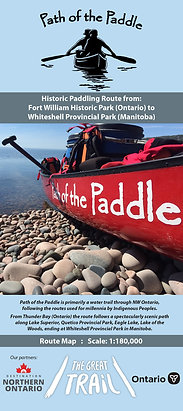
Path of the Paddle Association
2020
The Path of the Paddle Association operates the 1100km section of the Trans Canada Trail from Thunder Bay to Manitoba. This map covers extensive route options across Northwestern Ontario.
Availability:
Paper: In-print and available from Path of the Paddle Association and Wilderness Supply.
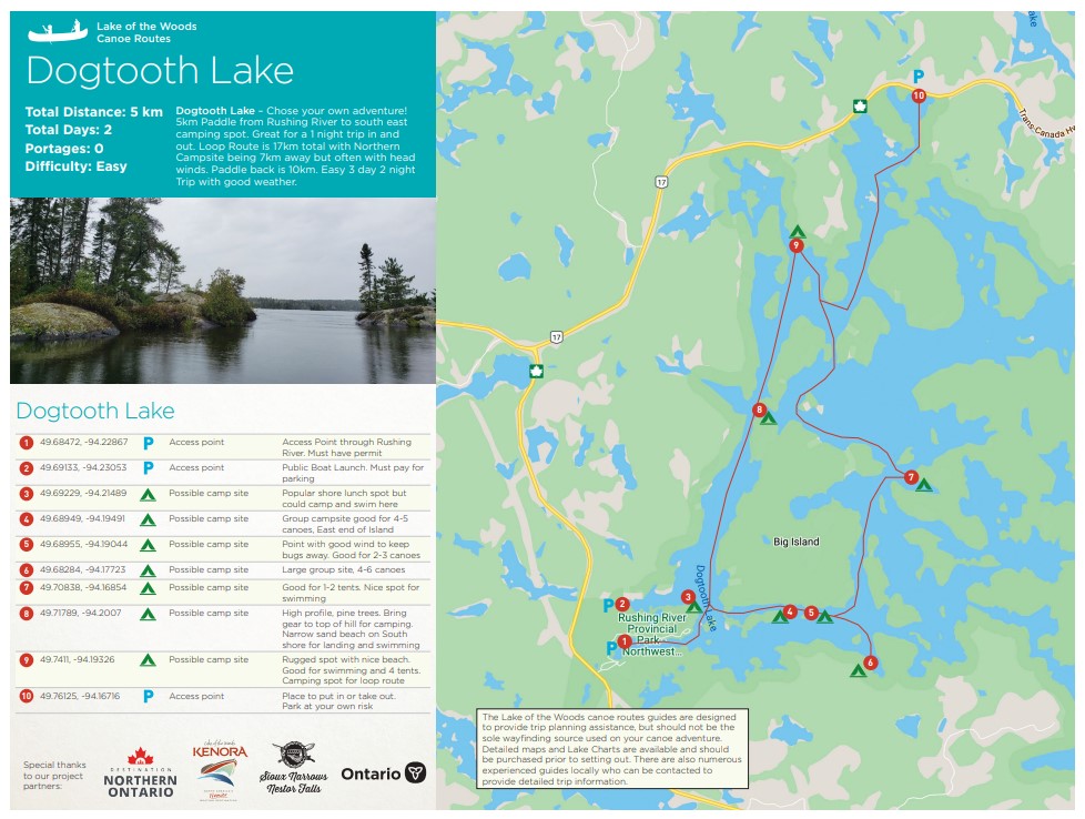
Kenora Area Route Maps
Destination Northern Ontario
City of Kenora
Sioux Narrows and Nestor Falls
Province of Ontario
These maps outline routes in the Kenora area. Details of campsites, portages, and access points, are outlined and noted on the accompanying map. Several routes are covered.
Availability:
PDF: See below for specific map links.
Dogtooth Lake Canoe Route
Ena Lake Canoe Route
Kakagi Lake Canoe Route
Keewatin to Minaki Canoe Route
Lake of the Woods Canoe Route
Stewart Lake Canoe Route
The Adventure Map:
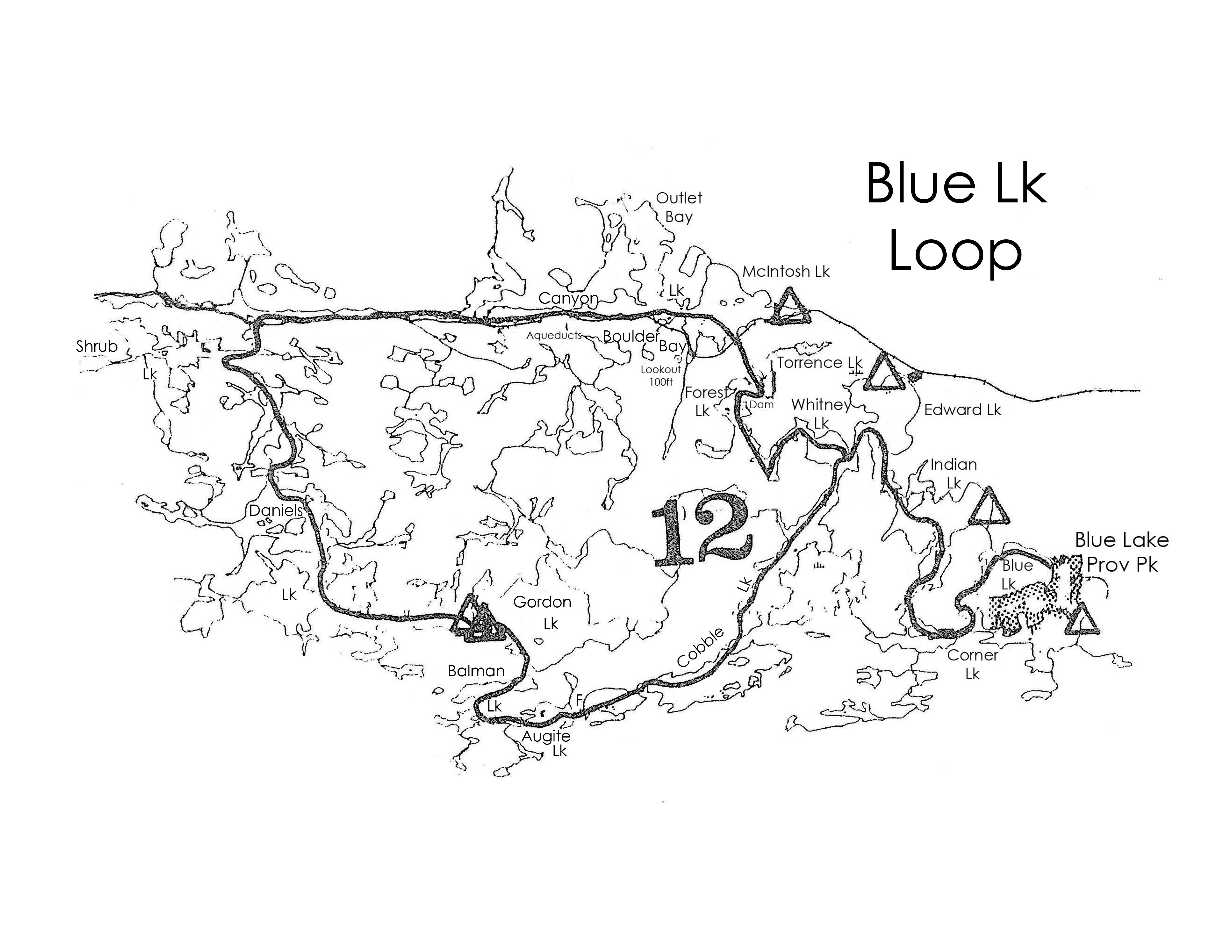
Woodland Caribou Provincial Park and Area
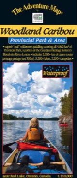
Chrismar Mapping Services
A detailed map of Woodland Caribou Provincial Park, and area, offering routes, portages, campsites, and more.
Availability:
Paper: In-print and available from several online retailers or direct from Chrismar Mapping Services.
The Adventure Map:
Quetico Provincial Park
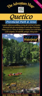
Chrismar Mapping Services
A detailed map of Quetico Provincial Park, and area, offering routes, portages, campsites, and more.
Availability:
Paper: In-print and available from several online retailers or direct from Chrismar Mapping Services.
Woodland Caribou Provincial Park
Access and Canoe Routes and Campsite Maps
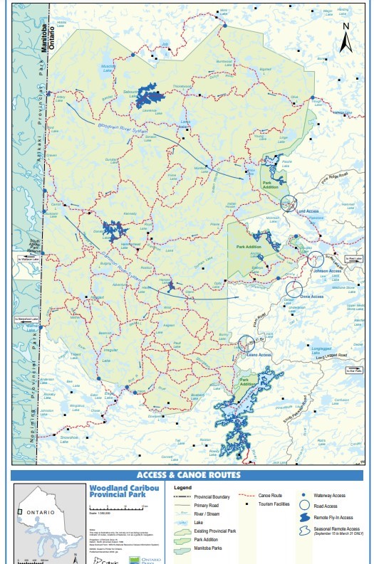
Province of Ontario
2009 - 2012
An overview of the entire park, it shows general canoe routes and access points. Woodland Caribou shares a border with Manitoba's Nopiming and Atikaki Provincial Parks.
Availability:
PDF: See below for specific map links.
Woodland Caribou Provincial Park Access and Canoe Routes Map
Woodland Caribou Provincial Park Campsites Map
Canoe Routes of Ontario Book Annotated Maps
Province of Ontario
1981+
The book Canoe Routes of Ontario is a compendium of more than 100 routes across the province. It does not offer details, but does include a general description and some notes on different routes. At the time of the book's printing, after selecting a route of interest, you would then write to the appropriate Ministry of Natural Resources District Office or Conservation Authority for a annotated map with further details.These maps are no longer available, but can be found in various forms on-line. The maps provided can vary and they are not all necessarily of the same quality.
Availability:
Paper: Out of print.
PDF/jpeg: MYCCR Ontario Canoe Routes


Follow us @paddlemanitoba, hashtag your own photos #paddlemb